One of the most beautiful hiking areas of Mauritius is the Black River Gorges National Park in the southwest of the island. In 1994, the 6,500-hectare area was created to protect the remaining indigenous forests of Mauritius. The park offers unprecedentedly beautiful landscapes with beautiful views, waterfalls, endemic plants and rare bird species.
Hikes in Black River Gorges National Park
There are many walks with a total length of about 60 kilometres that lead to all parts of the park. We describe some of our favourites below.
Black River Peak Trail
The hike to the Black River Peak leads to the 828-metre-high Piton de la Petite Rivière Noire, the highest mountain on Mauritius. Although there are several hikes to the top of the mountain, the trail from Plainer Champagne is the simplest and shortest. You can also visit the tourist viewpoint on the Gorges. Depending on your pace, you can be there and back in three hours. Get there early to have the peak to yourself but also for the best view, because usually the first clouds come late morning.
Bel Ombre Trail
A long but simple and beautiful walk in the park is from Plainer Champagne to the sugar cane fields of Bel Ombre. The almost-deserted but well-maintained path leads through some of the most pristine and beautiful forests on the island. The closer you get to Bel Ombre, the more likely you are to see wildlife. Plan the majority of the day for this hike.
There seems to be a very nice coastal walk from Bel Ombre to Riambel but we didn’t walk this one ourselves.
Colophanes Trail
From the entrance at Le Pétrin and the main entrance of Rivière Noire runs the popular but long Machabee Trail. On the way, you will arrive at a junction where you can also take the – in our opinion – even more beautiful Colophanes Trail. It’s more of a loop because this hike will eventually lead you back to the Machabee Trail. The views during the Colophanes route are even better than those on the main route. The walk is easy for almost everyone to do. The most challenging part is the bit between the Machabee viewpoint and the Colophanes path which is steep and can be muddy.
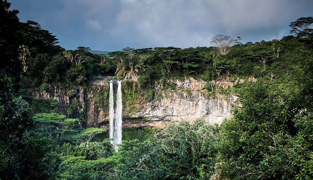
Alexandra Falls Hiking Trail
More or less at the beginning of the Plaine Champagne are the beautiful Alexandra Falls that should not be left out of your visit to the park. There is a car park and a well laid out viewpoint from where you have a fantastic view of the south coast and the forests at the Montagne Cocotte. From here, you can also do a nice, steep walk to another waterfall, namely the beautiful ‘Cascade de 500 pieds’ [500-foot waterfall] located in the south. The hike is not too strenuous but on the way back it is a bit of a climb.

Practical matters
Best time to hike in the Black River Gorges National Park
There are different microclimates. On the east side, you have the wooded, humid highlands with an annual precipitation of up to 4,000 mm. The lower west side with 1,000 mm rainfall is significantly drier. It is 4 to 6 degrees warmer here than on the east side. We have walked there in their summer, autumn and winter. Winter is the driest period and because the temperatures are also a bit lower, this is the best time to hike. January to March can be very wet and therefore smooth and slippery.
How to get there
The park has several entrances. The main entrance is located in Black River in the northwest where you also have the park’s visitor centre. We usually took the entrance at Le Pétrin in the east. Here, you have an information centre too. From here it is only a short distance by car or taxi to the Plaine Champagne, the road that leads to the most viewpoints on the Gorges and the Black River Peak Trail.